Archaeological drone thermography is one of the new methodologies that will be tested and analyzed during the phd project. The goals of the research are twofold: testing the potential of a new methodology of non-invasive archaeological investigation and identifing elements that fill the empty spaces of the medieval landscape to reconstruct the archaeological continuum.
Since the 1970s, archaeologists have known about the potential of infrared thermal images for identifying structures not visible on the surface, concentration of material, or landscape. elements such as roads, boundaries of cultivated fields, paleo-river beds, etc. Despite this long period, the excessive cost of the technologies used has greatly limited the possibilities of research. Now, a new phase of development is emerging throughout the explosion of the drone market. Expecially, the recent developments of commercial drones with thermal cameras are permitting on the one hand less espensive costs and on the other hand to speed up the search times.
The physical principle behind the analysis of thermal images is quite simple: the materials that are above and below the soilsurface absorb, emit or reflect infrared rays in different ways, based on their composition, density and moisture content. So a large amount of archaeological elements, can theoretically be identified in thermal images (see fig.1).
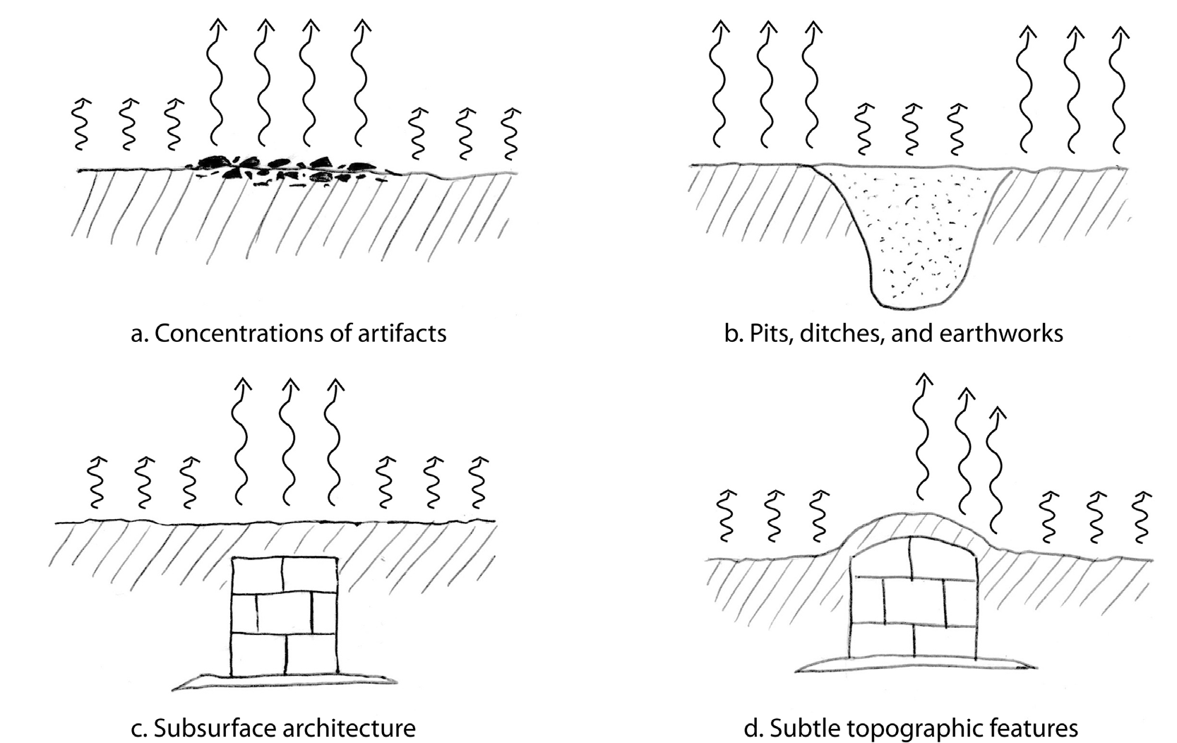 (Fig 1, from Casana et alii, 2017, pag. 311)
Other three factors are essential for the archaeological features to stand out in a thermal image: there must be a sufficient contrast between the thermal properties of the material and those of the soil; the archaeological material below the surface must be close enough to the surface to be affected by heat flux; the thermal image must be acquired when the thermal differences are more pronounced (see fig.2).
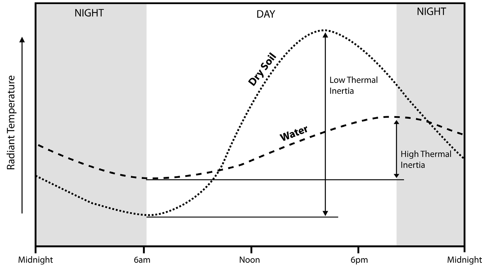 (Fig 2, from Casana et alii, 2017, pag. 311)
Bibliography:
Casana, J., Kantner, J., Wiewel, A., Cothren, J., 2014, Archaeological aerial thermography: a case study at the Chaco-era Blue J community, New Mexico. Journal of Archaeological Science, 45, 207--219. doi: 10.1016
Casana, J., Wiewel, A., Cool, A., Hill, A., Fisher, K., Laugier, E., 2017,. Archaeological Aerial Thermography in Theory and Practice. Advances, Archaeological Practice, 5(4), 310-327. doi:10.1017/aap.2017.23
Poirier N., Calastrenc C., Hautefeuille F., 2013, Low Altitude Thermal Survey by Means of an Automated Unmanned Aerial Vehicle for the Detection of Archaeological Buried Structures, International Journal of Archaeological Prospection, DOI: 10.1002/arp.1454
Poirier, N., Calastrenc, C., 2014, L'Utilisation des micro-drones pour la prospection archéologique à basse altitude. Colloque Scientifique Francophone Drones Et Moyens Légers Aéroportés d’Observation.